
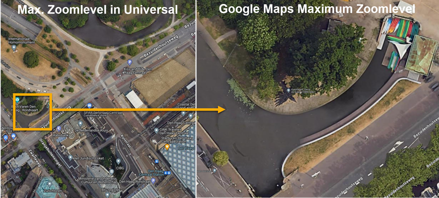
Would it be possible to show a higher maximum zoom level than currently available in Universal? This would allow us to determine and visualise more accurate work locations for a better user experience.

See the example below of the difference in maximum zoom levels between the current Google Satellite component in Universal and Google Maps:


The max zoom level is determined by your base layer provider. You can edit this in the map component in the SF:

If you find (or create) a tileset with high enough details, you can set the zoom level higher. Keep in mind that the URI should provide this. The google maps tiles I found support a max zoom level of 22, as seen in their docs.

So, check if your max zoom level matches that of your tileset and increase it if it doesn’t or you’ll have to search for a different tileset that supports a higher zoom level. I doubt the Universal GUI has anything to do with this.


According Google’s documentation, the Maps Tiles API seems to provide zoom levels up to 22, but it requires a SESSION TOKEN and and API KEY before tile requests will get a response

https://tile.googleapis.com/v1/2dtiles/z/x/y?session=YOUR_SESSION_TOKEN&key=YOUR_API_KEY


https://developers.google.com/maps/documentation/tile/roadmap

Is there a way to achieve this in the Thinkwise platform?


Reply