


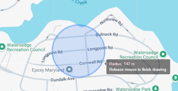
With the new 2025.2 release it is now possible to draw shapes directly on the maps component. For reference see:
In addition to drawing shapes, it would be of great benefit to my client that the surface area of the drawn shape is calculated (in square meters). Especially for complex polygons.
Ideally, when hovering over the drawn shape, this would show up in the popup. Just like what now happens when drawing a circle and the radius is displayed.
Use case: A farm field is divided into three zones, each planted with a different vegetable. On the map, when hovering over each zone, we’d like to display the surface area in square meters for each crop.
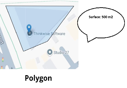
While we could calculate the area ourselves based on the coordinates, having this functionality built into the platform especially for irregular or complex shapes with many angles would be of a big added value.

