Hi. How do I create a scenario for automatic zoom level.
We are in Brazil so, the default is at level 5 or 6 to get an overview. But depending on the search I want to automatically zoom to state level or city level. How do I do that?

Hi. How do I create a scenario for automatic zoom level.
We are in Brazil so, the default is at level 5 or 6 to get an overview. But depending on the search I want to automatically zoom to state level or city level. How do I do that?
Currently this is not possible. You can set the initial zoom level but not modify it on the fly.
Currently this is not possible. You can set the initial zoom level but not modify it on the fly.
Ok, how do I turn this question into an idea?
Did you find a solution for this? We managed to make a work around for this. Not the most idea solution, but the end result works smooth in Universal.
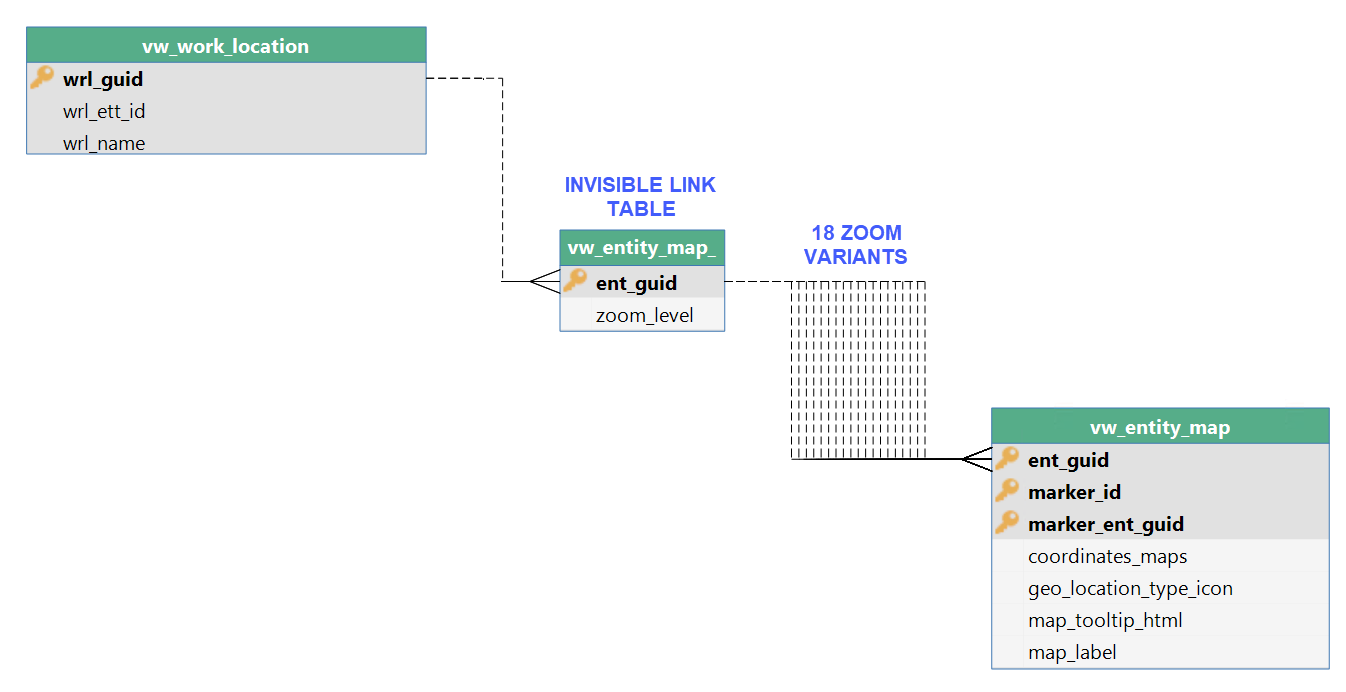
Our solution consists of a parent subject with 2 fields, id + zoomlevel and 18 details tabs for each zoom level a variant with its own zoom level. The right variant is made visible with a context procedure.
Did you find a solution for this? We managed to make a work around for this. Not the most idea solution, but the end result works smooth in Universal.
Our solution consists of a parent subject with 2 fields, id + zoomlevel and 18 details tabs for each zoom level a variant with its own zoom level. The right variant is made visible with a context procedure.
Hi
But if we get into this issue again, I'll know the work-around. Thanks for sharing that you have it. Still cannot really see how you steer the context to get to the right zoom level yet.
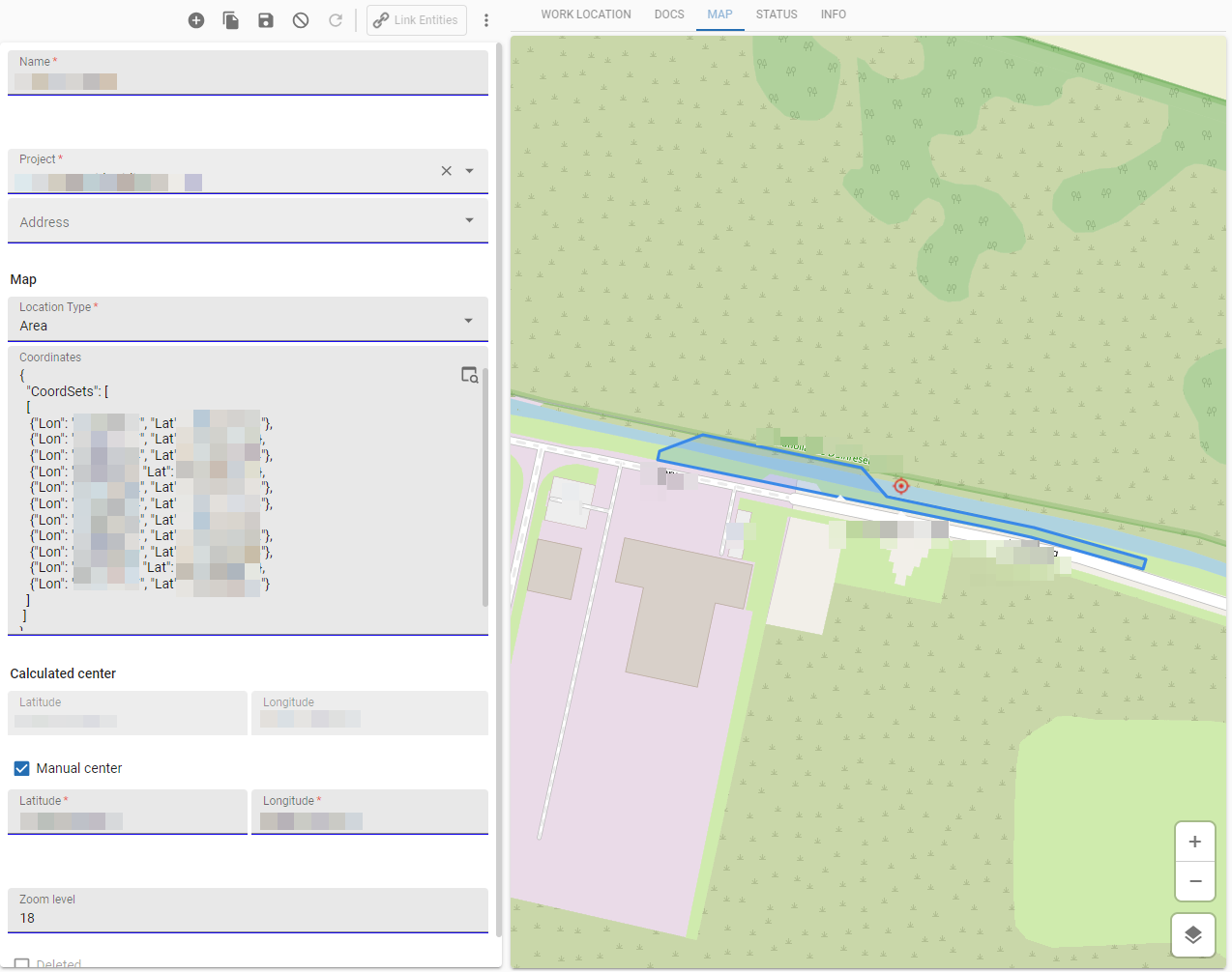
In our application a table called ‘Work Locations’ can be a geographic area, line or point.
We save the coordinates of the work location, a calculated center point a manual centerpoint (optional) and the zoom level.
2 views are used for the map:
The result:
Enter your E-mail address. We'll send you an e-mail with instructions to reset your password.